Fairburn's Location
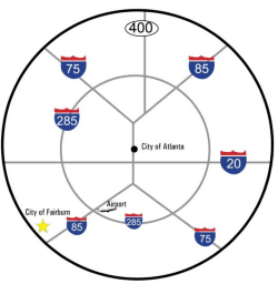 Fairburn is located just 20 miles south of Atlanta and 15 miles from Hartsfield-Jackson Atlanta International Airport. Adjacent to interstate 85 and appropriately 16 miles from access to Interstate 75 and 18 miles from Interstate 20, Fairburn is ideally located for both air and vehicular travel and provides incomparable access to the interstate system that serves the Southern US.
The City's logo and tagline perfectly explain Fairburn's unique advantage of location. The graphic icon, representing a map pin, ties the entire brand together. Each line within the icon's mark represents Fairburn's accessibility. the curved line represents 285, the diagonal line is 1-85 and the fork in that line is I-75. Finally, the red area is where Fairburn is located.

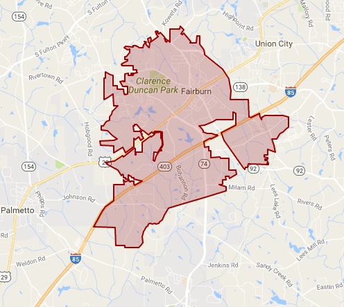 Locations in Fairburn, GA 30213
- Annex Building - 40 Washington St
- City Hall - 56 Malone St
- Duncan Park - 6000 Rivertown Rd
- Fire Dept - 149 SW Broad St
- Hobgood Palmer Library - 60 Valley View Dr
- Housing Authority - 88 Pine St
- Municipal Building - 26 W. Campbellton St
- Parks & Recreation Dept - 149 SW Broad St
- Police Dept - 191 SW Broad St
- Post Office - 75 Washington St
- Streets & Water Dept - 102 Howell Ave
- United Community Bank - 65 Washington St
- Utilities Dept - 106 Howell Ave
- VFW - 6449 Rivertown Rd
- Youth Center - 149 SW Broad St